UAS-based greenhouse gas emissions mapping in Arctic permafrost
Lead: Abdullah Bolek
UAS-based greenhouse gas emissions mapping in Arctic permafrost regions
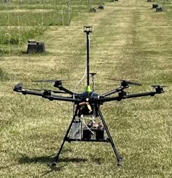
Spatial heterogeneity in surface characteristics is often very pronounced in Arctic landscapes, and variability at the finest scales is likely to increase in the future due to thawing permafrost and subsequent surface degradation. This causes high spatial variability also in surface-atmosphere exchange processes, including the carbon budgets. The current measurement techniques mainly rely on either eddy covariance towers or flux chambers to quantify the carbon budgets of the Arctic environment, with representativeness that is accordingly limited to relatively small footprint areas. Recent developments in unmanned aircraft systems (UAS) enabled a convenient and cost-efficient way to increase spatial coverage in the Arctic environment. Apart from the techniques that were developed for UAS-based data collections, including e.g. Aircore (Andersen et al. 2022), sampling via tubing (Scheller et al. 2022), and flask sampling method (Lampert et al. 2020), here we will be using in-situ techniques to measure CO2 and CH4 mixing ratios continuously along flight transects and profiles. In addition to the greenhouse gas signals, our system will also be collecting environmental data such as air temperature, humidity, pressure, and wind using meteorological instruments.
 and meteorological instrument (2D wind speed, temperature, humidity, and pressure).")
Collected UAS-based datasets will be used to differentiate the impact of the different landscape features on the Arctic carbon cycle, and facilitate to characterize the spatial variability of flux signals within heterogeneous permafrost landscapes. This information will be essential to evaluate the representativeness of stationary eddy-covariance systems for upscaling to the larger region. Along the same lines, integrating UAS-based datasets into the high-resolution surface-atmosphere models, UAS-based datasets could also be helpful for bridging the scale gap between in-situ measurements and climate models. High resolution datasets from gridded flights will also serve as a reference to evaluate high-resolution LES simulations over structured Arctic landscapes.
The first field campaign of UAV platform was conducted between 01/09/2023 and 22/09/2023 in Stordalen Mire, Abisko, Sweden. Grid survey flights were accomplished to identify potential hotpsots over the Stordalen Mire. Below figure shows the measured concentrations of CH4 and CO2 over three different areas from two different days.
 and 13-14/09/2023 (b and d). Here the flight altitude was 10 m above the ground level and the flight speed was 4 m/s.")

References
Bolek, A. and Testik, F., 2022. Atmospheric Boundary Layer Turbulence Measurements Using sUAS with Neural Network Application. In AIAA AVIATION 2022 Forum (p. 4112).
Andersen, T., Scheeren, B., Peters, W., & Chen, H. (2018). A UAV-based active AirCore system for measurements of greenhouse gases. Atmospheric Measurement Techniques, 11(5), 2683-2699.
Lampert, A., Pätzold, F., Asmussen, M. O., Lobitz, L., Krüger, T., Rausch, T., … & Damm, E. (2020). Studying boundary layer methane isotopy and vertical mixing processes at a rewetted peatland site using an unmanned aircraft system. Atmospheric Measurement Techniques, 13(4),1937-1952.
Scheller, J. H., Mastepanov, M., & Christensen, T. R. (2022). Toward UAV-based methane emission mapping of Arctic terrestrial ecosystems. Science of The Total Environment, 819, 153161.